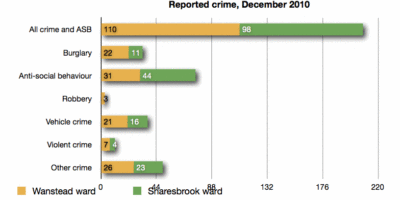
The real street-level detail of crime in Wanstead in December 2010 is now available from the new Police Crime Maps. The overview for Snaresbrook and Wanstead wards are as follows:

The detailed map shows that burglaries took place on or near Hermitage Walk, Hollybush Hill, Wanstead High Street (2), Wellesley Road, Grove Park (2), Nutter Lane, Leicester Road, Elmcroft Avenue, Elmcroft Close, Limes Avenue, Rodney Road, Colvin Gardens, Blake Hall Road, St Mary’s Avenue, Colebrooke Drive, Redbridge Lane West, Overton Drive, Blake Hall Crescent (2), Park Road, Albury Mews, Dover Road, Clavering Road, Merlin Road and Church Avenue.
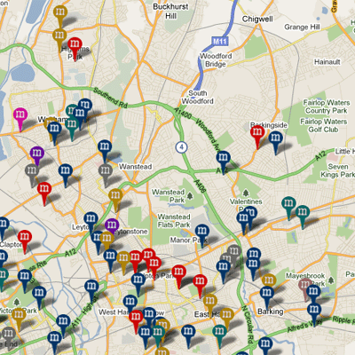
When the maps are working fully, it will be easy to compare one neighbourhood with another – and it’s a fair bet that compared to Ilford, Leytonstone and Walthamstow, Wanstead will come out well. So, ever on the lookout for ways to be of public service, Wansteadium here offers a Nick Ross “don’t have nightmares” thought; the map below comes from Murder Maps, a remarkable site which claims to have plotted all murders in London since the days of Jack the Ripper. Despite all the unfortunate murders indicated on the map, not one of them happened in Wanstead.
Sleep well.


