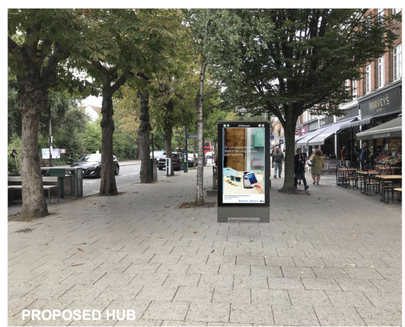
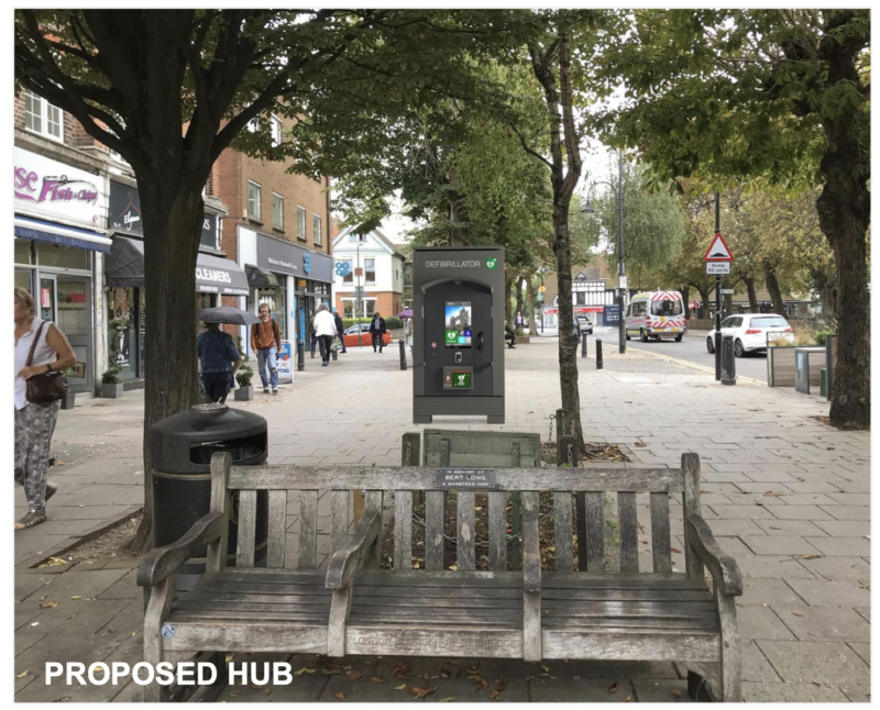
A letter to Lord Sugar: Ye Cherry Pie has got a soggy bottom

Dear Lord Sugar

Wanstead has loads of history, but not much of it is left for us to enjoy today.

One exception is the Cherry Pie sign on the side of the George. The story behind the sign, which is dated 1752, is a bit mysterious, not least because the building is much more recent than that.

One theory, passed down the generations, is that a workman was up a ladder, leaned against the wall and stole a cherry pie from a vendor who passed by with a tray on his head. The workman was brought before court for this minor crime and fined half a guinea, hence the “cherry pey as cost half a guinea”.

Wikipedia tells us more:

The most likely explanation is that it was placed there by the landlord of 1752, David Jersey (corrupted by centuries of repainting and re-cutting the inscription to D Jerry on the plaque), commemorating a feast which included a huge cherry pie. Monstrous pies were a feature of 18th-century Essex rural festivals; the Galmpton Gooseberry Pie Fair in Devon is still in existence, and other inns around the edge of Epping Forest were famed for pies (rabbit pie at The Reindeer, Loughton, now Warren House, and pigeon pie at The King’s Head, Chigwell). Wanstead was well known for its cherry orchards as late as the 1830s, when they were mentioned by poet Thomas Hood, who lived in Wanstead 1832–5.


So you can see this is a charming bit of Wanstead history, which is in your stewardship since you own the building that the George is in. And yet it looks like it’s in a bit of trouble.

A leaky downpipe has clearly made the side of the wall damp. It’s now covered in green mossy stuff, and it will surely not last much longer unless urgent attention is taken.

Please, Lord Sugar, make sure this is sorted.

Best wishes

Wansteadium

More car charging points on their way

Residents are to be given the chance to get on-street electric car charging points near their homes as Redbridge plans a roll-out of 310 more sites across the borough.

The council has secured more than half a million pounds from the Government’s Office for Zero Emission, which funds 75% of the costs. The remaining 25% will be funded either by the council, or by commercial partners. There are currently 59 publicly available charging points in Redbridge.

The charging points should allow people without off-street parking to consider changing to an electric car. The council said sites would be agreed partly on the basis of feedback from residents.

Wanstead councillor Jo Blackman, who is the Redbridge Cabinet member for the environment, said: “We’re on the cusp of something really exciting with the prospect of the electric vehicle revolution. What’s vital is that we have the proper infrastructure to ensure there are no barriers to people using electric vehicles. 

“The installation of these charge points will provide easy access to people, where off-street parking is not an option for them. As more residents move to more environmentally-friendly travel, communities will inevitably benefit from improved air quality and lower their carbon footprint.”

There IS a plan to upgrade zebra crossing

Pic: Jennifer Baptist

Without making a fuss about it, Redbridge Council does have a plan to upgrade the controversial zebra crossing on Wanstead High Street.

It is planning to raise the level of the road at the crossing near the Co-op so that it is kerb-height, helping slow drivers and also making pedestrians more visible.

The plan is one of a number of speed bump proposals the council has in motion -and was spotted by long-time Wansteadium reader Richard Menzies, who contacted us after our stories last week.

He writes about the speed bump notification:

The notice in relation to speed bumps – at paras 1(o) and 2 – proposes a 12m long (i.e. 12m along the road) flat-topped kerb-to-kerb speed bump on Wanstead High Street, centred “approximately 12 metres south-east of the south-eastern kerb line of Grove Park”. This one stands out a bit from the others in the list as it is the only one on this side of Cambridge Park Road/Eastern Avenue and it is a lot ‘wider’ than the other humps/cushions.

It is around 26m from Grove Park to Woodbine Place, with the zebra crossing approximately in the middle. It sounds as though they are proposing to make this a ‘humped’ zebra crossing.

We’ve asked Redbridge to confirm if this indeed the plan.

Various ideas have been floated by other readers for addressing the problems with the current crossing – with one reader, CB, proposing a 20mph speed limit on Wanstead High Street, to match similar measures introduced in Waltham Forest.

Changes for Wanstead roads

Google Streetview

Redbridge plans to introduce speed humps on Redbridge Lane West, the Green, St Mary’s Avenue and Mansfield Road.

In 2020 we reported that residents in Mansfield Road were campaigning for traffic calming measures because motorists were using the road as a rat-run to avoid the lights at George Green.

St Mary’s Avenue and Overton Drive are often used by motorists to avoid the congestion on Blake Hall Road, though they of course have to contend with the width restriction bars, which can take nerves of steel.

Elsewhere, the council plans to make part of Nightingale Lane one way. Traffic would not be allowed to go from the junction with Wellesley Road to the High Street, though going the other way would still be permitted.

Details of how to make representations about the changes are included on the statutory notices pictured below. (Click or tap images to enlarge.)

Is Wanstead zebra crossing unsafe?

Image: Google

Lots of questions being asked about the zebra crossing near the Co-op on Wanstead High Street after another collision involving a car and a pedestrian. Whatever the details of this latest incident, the matter of whether it is inherently unsafe is being raised again. Just for the record, here are some of the points

  • Is the crossing in the wrong place and would a position further up the High Street (eg outside the Lighthouse fish and chip shop) be better? 
  • Do the trees on either side of the road restrict the view for drivers and pedestrians?
  • Does the informal nature of a Zebra crossing mean it’s less obvious when drivers should stop and when pedestrians should walk? Would a Pelican crossing be safer?
  • Do the left turns from Grove Park and Woodbine Place increase the risk of accidents?
  • Would a raised platform for the Zebra crossing improve visibility?

 It would also be interesting to see how incident statistics for this crossing compare with other similar crossings. The intriguing site Crashmap.co.uk plots all incidents of different severity and gives a wider indication of how widespread road collisions are.

Image from www.crashmap.co.uk, using DfT data. Background map from Google. Incidents from 2016 to 2020.